
Declination Circles 101
A declination circle represents the Sun’s path viewed from a fixed point on the Earth for 24 hours. There are ways to draw a declination circle with just a ruler and protractor/compass to quickly and accurately know the Sun’s position in the sky at any day and time of the year for any location on Earth. To quickly learn how to draw and interpret declination circles, be familiar with latitude and solar declination in the last part of the Sun-Earth Connection section.
Declination Circles
The Sun is not moving (actually it is, but it is not noticeable to us), but we perceive that the Sun is moving in the sky since Earth is rotating. We turn 15º/hour (360º / 24 hours), but we also move a little less than 1º/day in our orbit around the Sun (360º / 365.25 day). The effect of rotation dominates the apparent motion of the Sun, but the slight change in Earth’s orbital speed (see eccentricity of our orbit) affects the length of a solar day by up to 15 minutes during a year.
Declination circles map the path of the Sun across the sky as viewed from a point on the Earth’s surface at a given latitude and day of the year. When viewing a declination circle, imagine you are standing in the middle of the diagram – essentially in the middle of your horizon.
Declination circles are essential to understand so we may navigate, build more energy-efficient homes and buildings, design cities, plant gardens that thrive, take photographs, film movies, etc.
Sun-Day Challenges Web App
The easiest declination circle to draw is when viewing the Sun’s motion from exactly west looking east. The path of the Sun appears to move in a straight line, which is easy to draw with a ruler. Use the web app, Sun-Day Challenges to learn how to interpret these declination circles to identify the date, the solar declination, and the latitude.
The app has three types of activities:
-
- Explore how declination circles change as you select latitude and day.
- Practice identifying solar declination, day, and latitude for randomly generated declination circles. Visual and written feedback are provided with each response.
- Quiz mode with less guidance to see how well you understand the processes.
Click the button to run the Sun-Day Challenges web app.

This is the opening activity for the Sun-Day Challenges web app. Explore how declination circles change with latitude and day of the year.
Use the supporting information below to answer your questions generated using the app, read beforehand and test your understanding as you use the app, or go back and forth between the app and the information.
Conventions for Declination Circles
We will use the following conventions for all declination circles:
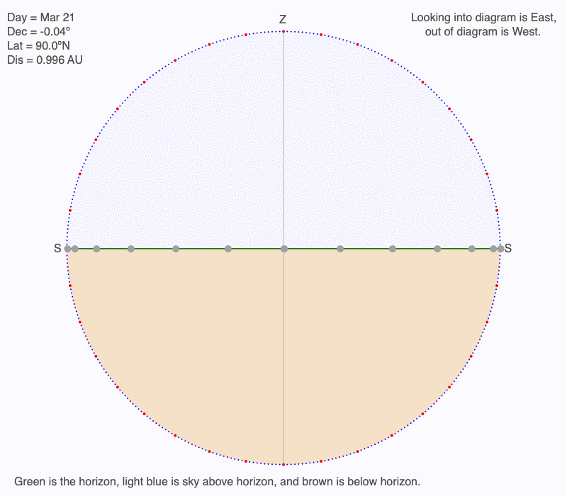
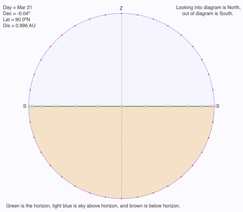
- The horizon is green, the sky is a pale blue, and the ground is light brown.
- Solid circles mark the hourly positions of the Sun. When the Sun is above the horizon, it is orange, and when below it is gray.
- The declination circle with the hourly positions of the Sun is gray.
- 24-hour time is used to label the hour position of the Sun. 0 = midnight, 20 = 20 – 12 = 8 PM.
- Zenith, the point directly overhead an observer, is marked with “Z.”
- To measure angles of the declination circle, a dotted circle is drawn centered about a fictitious person standing in the middle of the horizon directly beneath the zenith. Every ten degrees is marked with a red dot.
- Sunrise and sunset occur at the location where the declination circle intersects the horizon.
- Time on the declination circle does not refer to clock time but rather the time based on the Sun’s movement. Clock time takes into account your longitudinal location in your time zone.
- On a North-South oriented declination circle:
- Where the declination circle touches the outer circle at its highest point is local noon, which is always 12 PM. Local noon is when the Sun is highest in the sky.
- Where the declination circle touches the outer circle at its lowest point is local midnight, which is always 12 AM. Local midnight is when the Sun is lowest in the sky (even when below the horizon).
North-South oriented declination circle that shows the time and location of sunrise, sunset, local noon, and local midnight.
For more information and activities to explore the time of the Sun’s position on a declination circle, go to Interpreting Time on Declination Circles, which includes several web apps to practice and quiz yourself.
Declination Circles for 30ºN on March 21
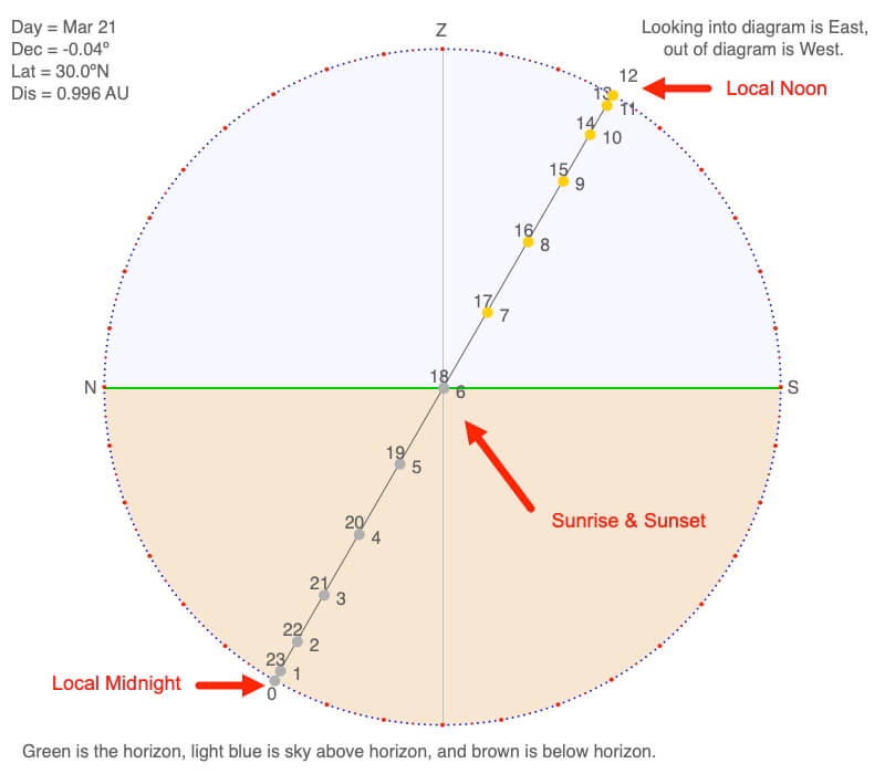
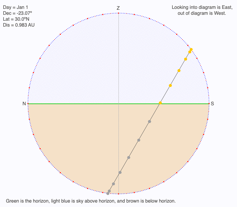
Below are three views of a declination circle for 30ºN on March 21, an equinox.
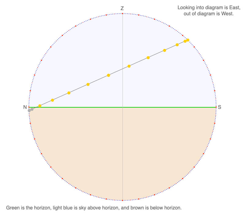
View the declination circle from the side, so it looks like a tilted straight line. North is to the left and south to the right. This means that west points out of the drawing, and it meets the horizon directly beneath the zenith (Z). East is looking directly into the drawing.
Sunrise is exactly east and occurs at 6 AM. Sunset is precisely west at 6 PM, and there are 12 hours of daylight and 12 hours of darkness.
The Sun is located 60º above the horizon and directly south at local noon.
The Sun is located 60º below the horizon and directly north at local midnight.
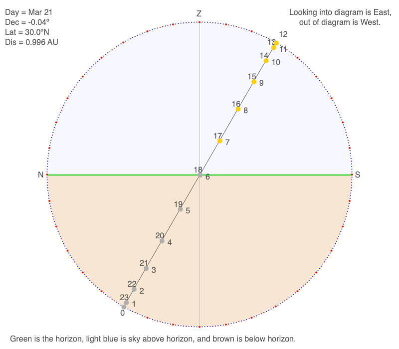
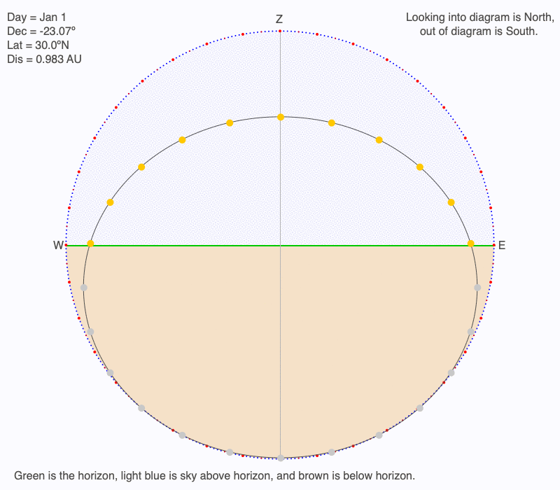
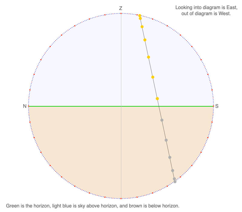
Now view the declination circle from the front, so it looks like a squashed circle. West is to the left and east to the right. This means south points out of the drawing and it meets the horizon directly beneath the zenith (Z). north is looking directly into the drawing.
Since the Earth rotates from west to east, the Sun appears to move from east to west across the sky. Near sunrise and sunset, the Sun changes angle above the horizon more quickly than at local noon. Near local noon, the angle above the horizon doesn’t change much, but the east to west movement is more pronounced.
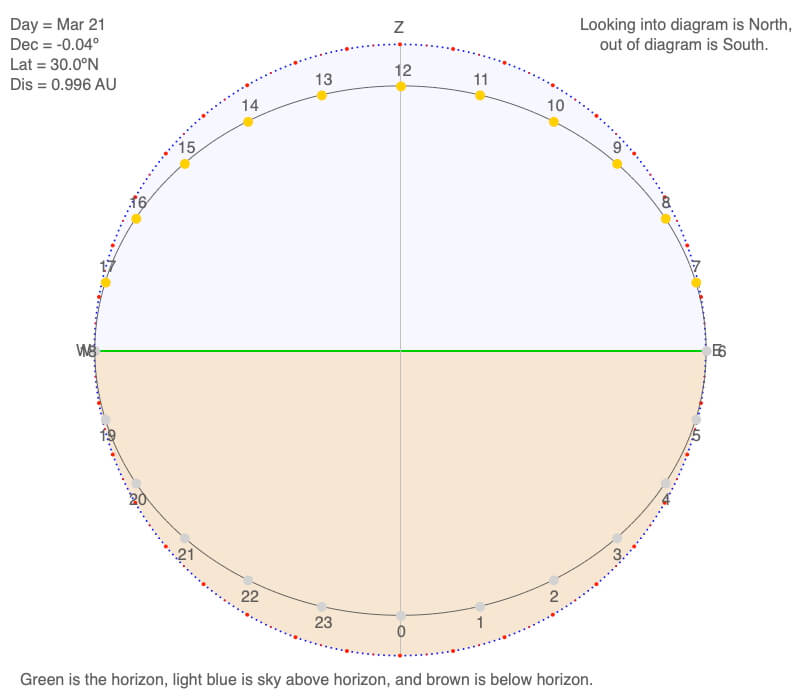
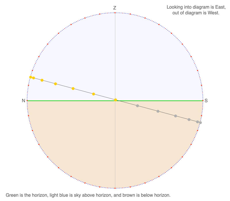
Finally, view the declination circle from the above, and it looks like a squashed circle. West is to the left, east to the right, north to the top, and south at the bottom. This means zenith points out from the center of the diagram.
Except at sunrise and sunset, the sun is south of your location throughout the day.
Each of these three views of the declination circle show provides a different perspective of how the Sun moves across the sky. This view makes it easy to see the location and length of shadows during the day.
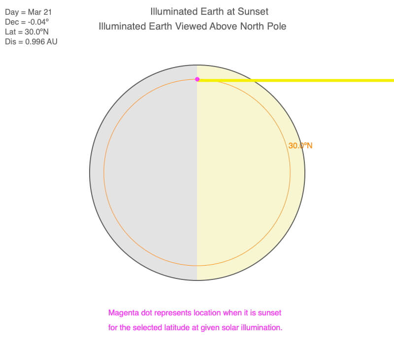
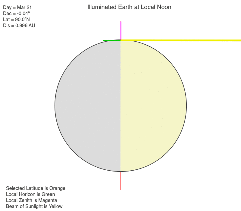
Verification of Declination Circle for 30ºN on March 21
Below are views of the Earth’s illumination on March 21. The orange line/circle is 30ºN. The declination circle provides all this information and so much more in one diagram.
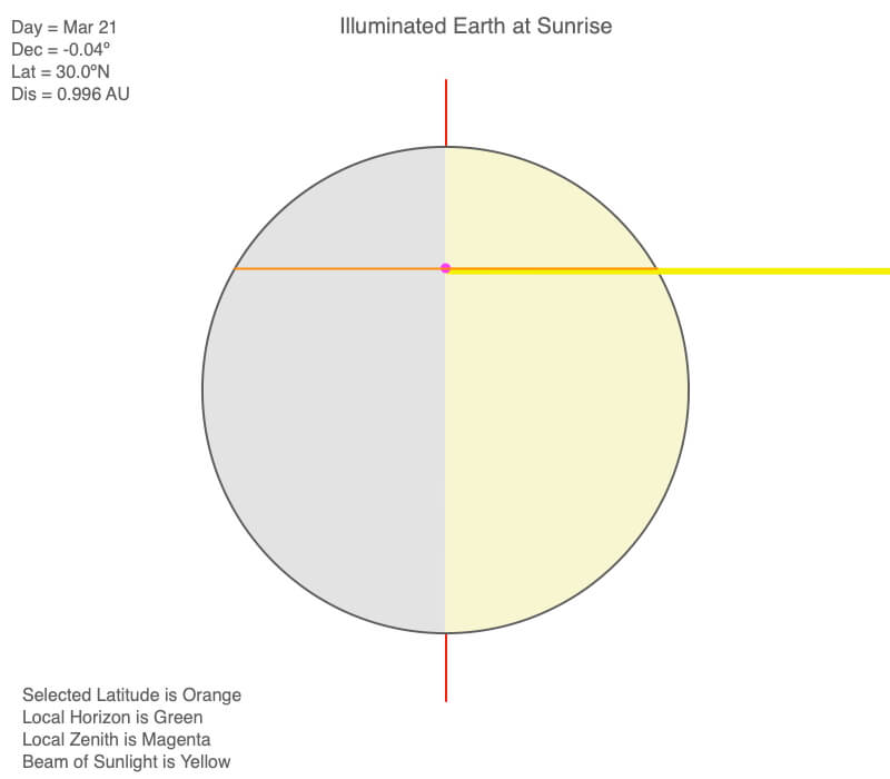
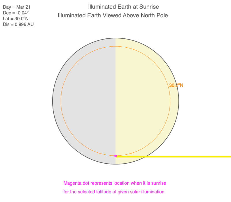
Viewing the Earth illumination at sunrise on March 21, notice that the sun shines parallel to the 30ºN latitude. This means the Sun is due east at sunrise.
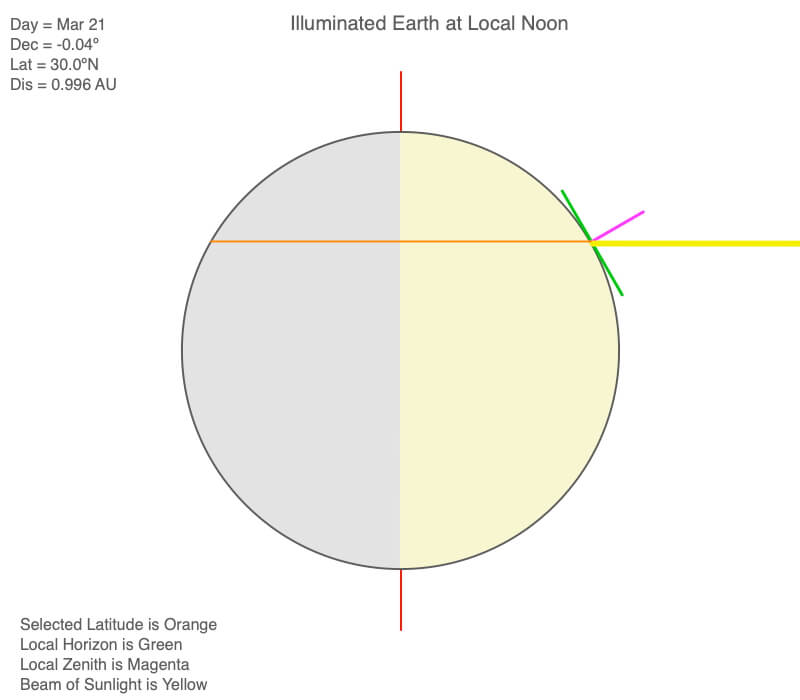
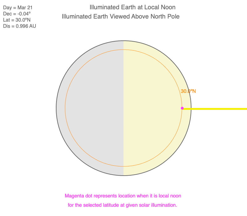
Viewing the Earth illumination at local noon on March 21, the sun is 30º due south from the zenith.
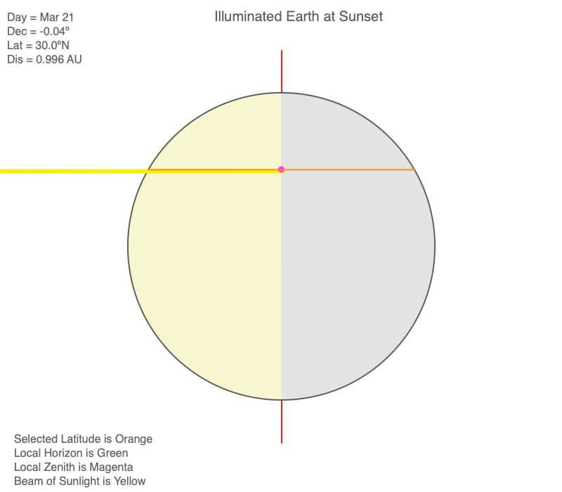
Viewing the Earth illumination at sunset on March 21, notice that the sun shines parallel to the 30ºN latitude. This means the Sun is due west at sunset.
Declination Circles and Latitude
The orientation of the horizon relative to the Earth’s axis of rotation plays a primary role in how the Sun tracks across the sky for a given day of the year. Recall from the Earth’s Coordinate System that latitude defines the horizon’s orientation.
Below are animations of declination circles for latitudes every 10º starting at the North Pole for March 21, an equinox. Compare the trends to the Earth’s illumination on March 21 at local noon as latitude changes.
Every declination circle passes through the center of all horizons during an equinox.
The declination circle is perpendicular to the horizon at the Equator during an equinox.
Except for the poles, declination circles slope toward the north in the Northern Hemisphere and south in the Southern.
During an equinox, the Sun stays in the horizon all day at the North and South Poles. The declination circles at these latitudes are parallel to the horizon.
The Sun illuminates half the Earth extending from the North Pole to the South Pole during an equinox. As latitude changes, the orientation of the horizon relative to the Earth’s axis of rotation changes.
The Sun is in the horizon at the poles throughout the day. For all other latitudes, the Sun is highest in the sky at local noon. In the Northern Hemisphere, the Sun is south of the zenith. In the Southern Hemisphere, the Sun is north of the zenith.
Declination Circles and Day of the Year
As the Earth orbits the Sun, the orientation of the axis of rotation toward the Sun changes. This changes the solar declination, indicating how much and how intensely the Northern and Southern Hemispheres are illuminated by the Sun.
Below are animations of declination circles for 30ºN starting on January 1 and increasing 15 days per frame. Compare the trends to the Earth’s illumination throughout the year at 30ºN.
Declination circles are parallel for a given latitude throughout the year. How far apart they are from each other depends on the rate of change in solar declination. Near the solstices, declination changes slowly. Near the equinoxes, it changes most quickly.
Around the summer solstice, which is June 21 for the Northern Hemisphere, more of the declination circle is above the horizon. The local noon sun angle is also higher. Around the winter solstice (December 21), more of the declination circle is below the horizon (shorter duration of daylight), and the Sun is lower in the sky at local noon.
As the orientation of Earth’s axis of rotation toward the Sun changes during the year, the Earth’s illumination changes. As the Northern Hemisphere points more toward the Sun, more of the hemisphere is illuminated and the Sun is higher in the sky. As the hemisphere points away from the Sun, less of the Earth is illuminated and the Sun is lower in the sky.
Challenge Questions
Use the information in the diagram above
Northern or Southern Hemisphere?
The declination circle slopes toward the north, so this is the Northern Hemisphere.
High or Low Latitude?
The declination circle is not very steep, so this is a high latitude (actually it is 66º- see the hemisphere question for N or S).
Amount of daylight? More, less, or about 12 hours?
A considerable proportion of the declination circle is above the horizon, there are many more hours of sunlight than darkness.
Sunlight >> 12 hours
Close to an equinox or solstice?
During an equinox, the declination circle passes through the center of the horizon in the diagram (rises east, sets west, and there are 12 hours of daylight and darkness). This declination circle crosses the horizon nearly to the north. This is near a solstice.
What is the local noon Sun angle?
The Sun is 46º above the horizon (or 44º south from the zenith).
Use the dots on the outer circle which are 1º apart, and every tenth dot is red.
Use the information in the diagram above
Northern or Southern Hemisphere?
The declination circle slopes toward the south, so this is the Southern Hemisphere.
High or Low Latitude?
The declination circle is quite steep, so this is a low latitude (actually it is 12º – see the hemisphere question for N or S).
Amount of daylight? More, less, or about 12 hours?
A just over half of the declination circle is above the horizon (there are 7 orange hour positions and 6 gray ones).
Sunlight ~ 12 hours (actual is 12.7 hours)
Close to an equinox or solstice?
During an equinox, the declination circle passes through the center of the horizon in the diagram (rises east, sets west, and there are 12 hours of daylight and darkness). This declination circle crosses the horizon well south of east. This is near a solstice.
What is the local noon Sun angle?
The Sun is 79º above the horizon (or 11º south from the zenith).
Use the dots on the outer circle which are 1º apart, and every tenth dot is red.
Use the information in the diagram above
Northern or Southern Hemisphere?
The declination circle slopes toward the south, so this is the Southern Hemisphere.
High or Low Latitude?
The declination circle is not very steep, so this is a high latitude (actually it is 75º – see the hemisphere question for N or S).
Amount of daylight? More, less, or about 12 hours?
A wee bit more than half the declination circle is above the horizon (there are 7 orange hour positions and 6 gray ones).
Sunlight ~ 12 hours (actual is 12.3 hours)
Close to an equinox or solstice?
During an equinox, the declination circle passes through the center of the horizon in the diagram (rises east, sets west, and there are 12 hours of daylight and darkness). This declination circle crosses the horizon quite close to east. This is near an equinox.
What is the local noon Sun angle?
The Sun is 16º above the horizon (or 74º north from the zenith).
Use the dots on the outer circle which are 1º apart, and every tenth dot is red.
Continue Exploring Declination Circles
Sun-Earth Connection desktop app has a section to drawing and interpreting declination circles. Explore declination circles for your latitude or your favorite time of year. Go to the Software page to download a version for Macs or PCs.
Big Ideas
- Solar declination is the angle between the Sun’s rays and the plane of the Earth’s Equator.
- An equinox occurs when the declination is 0º that day (March 21 and September 22, currently).
- A solstice occurs when the declination is ±23.5º (June 21 and December 21, currently).
- The range of solar declination is equal to the Earth’s obliquity.
Click on the following toggles to view descriptions and links of the web pages on each topic of the Sun-Earth Connection.
Sun-Earth Connection overview
An overview of how the Sun’s energy is generated and how its thermal radiation illuminates and heats Earth.
Earth Illumination Patterns
- Overview: The Sun illuminates the spherical, rotating planets orbiting it.
- Obliquity and Earth’s Illumination: Obliquity is the angle between the planes of the Earth’s equator and its orbit around the Sun.
- Declination, Latitude, & Earth Illumination: Solar declination is the angle between the Sun’s rays and the plane of the Earth’s Equator. Its value depends on where Earth is in its orbit around the Sun.
- Astronomical Seasons & Illumination: Astronomical seasons are based on the orientation of Earth’s axis of rotation to the Sun, which determines the amount of illumination between the Northern and Southern Hemispheres.
Distribution of the Sun's Energy on Earth
- Overview: Even though an area is illuminated by sunlight, there can be quite a range of energy interacting with the surface.
- Sun Angle and Beam Concentration: If every beam of sunlight reaching Earth has the same amount of energy, why do some areas warm up more than others?
- Diurnal Heating: Diurnal heating is the temperature change over 24 hours. When sunlight shines on the ground, it warms. Two critical factors that determine the amount of heating deal with the Sun’s illumination.
- Seasons: Earth experiences astronomical seasons due to its obliquity.
- Climate Regimes: Climate regimes are an extension of diurnal heating and seasons, but the time frame is now years.
Declination Circles: A tool to analyze the Sun's position in the sky.
- Overview: Drawings of declination circles contain the visual and numerical information to understand and predict the Sun’s motion across the sky.
- Declination Circles 101: Draw a declination circle with just a ruler and protractor/compass to quickly and accurately know the Sun’s position in the sky at any day and time of the year for any location on Earth.
- Drawing Declination Circles: Declination circles are quite easy to draw by hand.
- Interpreting Time on Declination Circles: Accurately estimate the time of day using the Sun’s location in the sky.
- Sunrise, Sunset, & Twilight: Calculate the timing and duration when the Sun is at or near the horizon.
- Solar Time, Angle, & Position: The sun’s angle and direction to the local horizon define the Sun’s position in the local sky. Explore how to use declination circles to calculate the Sun’s position at any solar time anywhere in the world on any day of the year.
- Changing Views of Declination Circles: Use the web app View Declination Circles to explore three common views of declination circles to identify their strengths, limitations, and applications. Then learn how to go from one view to another.
- Using Declination Circles: Humans have been using the apparent motion of the Sun as a compass, clock, and calendar for millennia.
- Using Sundials: Humans have been using the Sun’s position to navigate and tell the time, day, and season for millennia. Sundials create shadows that make it easier to do these tasks.
0 Comments