Declination Circles
A Tool to Analyze the Sun’s Position in the Sky
Drawings of declination circles contain the visual and numerical information to understand and predict the Sun’s motion across the sky, which allows us to:
-
- navigate accurately,
- design more energy-efficient homes, factories, office buildings, and cities,
- design healthy and productive gardens,
- understand the diurnal and seasonal patterns of plants and animals,
- and so much more.
Not bad for something that can be created with a ruler and a protractor!
Computers and calculators are powerful tools to calculate answers, create animations, process data, etc. As you learn about the fundamental processes they are doing, you can use their tools more creatively and accurately. For example, children need to be comfortable adding, subtracting, and dividing by hand/mentally when they use a calculator. This way, they can use their calculator more intuitively and effectively while also recognizing when they made a mistake. “Black boxes” are more useful when we understand what they do and how they do it (the expansion of artificial intelligence will test this belief!). So although Science Pickle uses software (web and desktop apps) to introduce, visualize, and calculate declination circles for any location and day of the year on Earth (and any planet), we are going to learn how to draw and interpret these visualizations and calculate variables manually, which will help you use declination circles in more creative ways for your own needs.
Activities using Declination Circles
The easiest declination circle to draw is when viewing the Sun’s motion from exactly west looking east. The Sun’s path appears to move in a straight line, which is easy to draw with a ruler. Use the web app, Sun-Day Challenges, to interpret these declination circles to identify the date, the solar declination, and the latitude.
The app has three types of activities:
-
- Explore how declination circles change as you select latitude and day.
- Practice identifying solar declination, day, and latitude for randomly generated declination circles. Visual and written feedback are provided with each response.
- Quiz mode with less guidance to see how well you understand the processes.
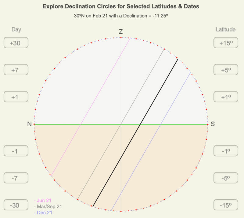
This is a screenshot of the opening activity of the Sun-Day Challenges web app.
Draw a north/south-orientated declination circle with a straight edge and a protractor or a template.
The Drawing Declination Circle web app coaches you through the four basic steps to drawing a declination circle for any latitude and day of the year. There are written and visual hints, tips, and feedback for each step, and you may set the date and latitude yourself or use the random option to challenge yourself.
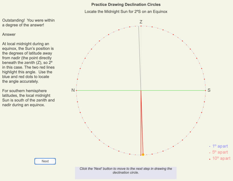
Screenshot from the web app Drawing Declination Circles.
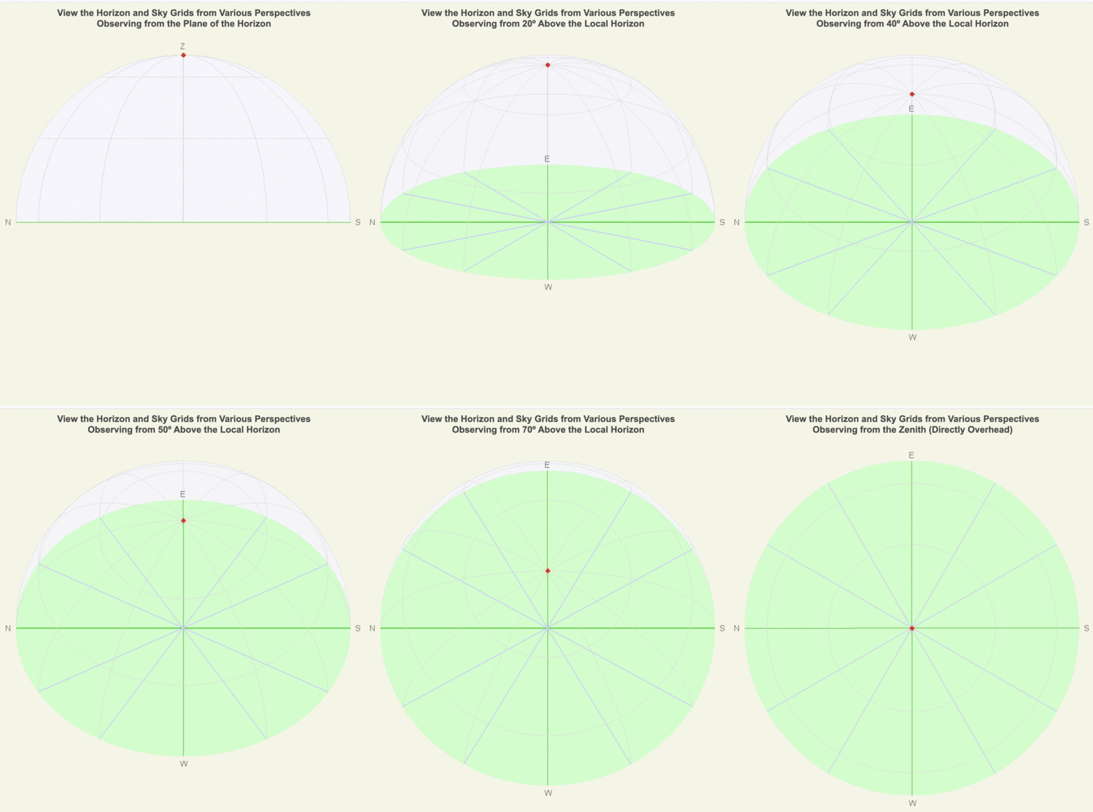
Animation of viewing the horizon and sky from changing vantage points.
Interpreting Time on Declination Circles
Learn how to estimate the time of the Sun’s position on a north/south-orientated declination circle.
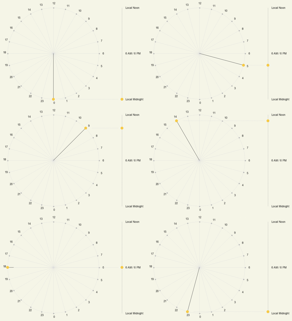
The following is an animation showing the hourly position of the Sun on a declination circle when viewed from the front (left) and the side (right). Time on the left is shown as 24-hour time, where, for example, 18 = 6 PM.
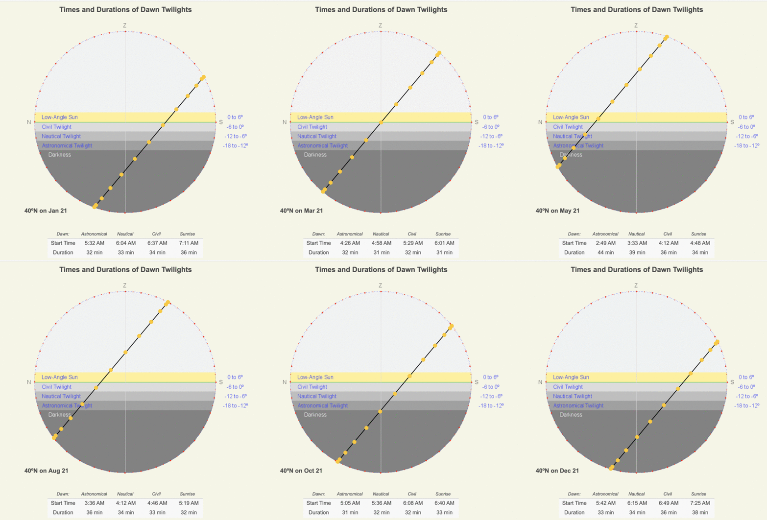
Twilight is the time of day where the sky is lighter than the nighttime sky, but the Sun is below the horizon. There are three stages of twilight based on what we can see when there are clear skies:
-
- Civil Twilight: the Sun is within 6º below the horizon, and there is enough light to carry out ordinary outdoor activities.
- Nautical Twilight: the Sun is between 6º and 12º below the horizon, but both the horizon and brightest stars are visible, so navigation is possible.
- Astronomical Twilight: the Sun is between 12º and 18º below the horizon, and there is only a faint sky glow at this time.
Use several web apps to explore how the timing and duration of twilight change with latitude and day of the year.
The following animation shows how the timing and duration of twilight change each month at 40ºN.
Solar Time, Angle, and Direction
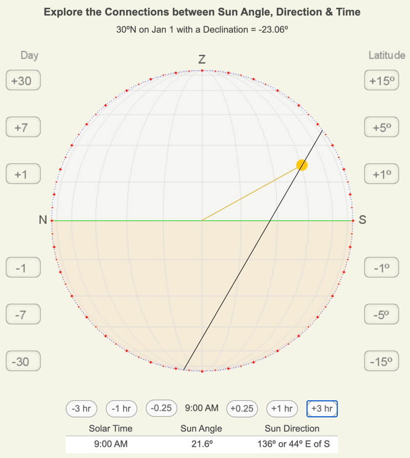
The sun’s angle and direction to the local horizon define the Sun’s position in the local sky. Explore how to use declination circles to calculate the Sun’s position at any solar time anywhere in the world on any day of the year. Connect latitude, day of the year, solar time, and sun angle and position, so if you know four of the variables, you may calculate the fifth!
Changing Views of Declination Circles
Use the easiest declination circle to draw (north/south-oriented) to create the east/west-oriented view and a view from above (see the adjacent three images). Each perspective has unique visualization strengths, limitations, and applications.
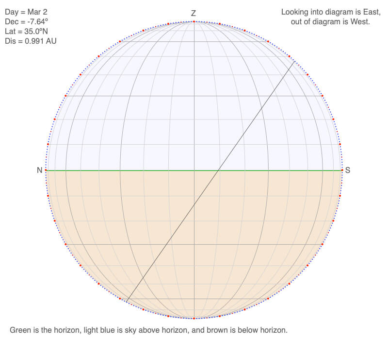
A north/south-oriented declination circle for 35ºN on March 2.
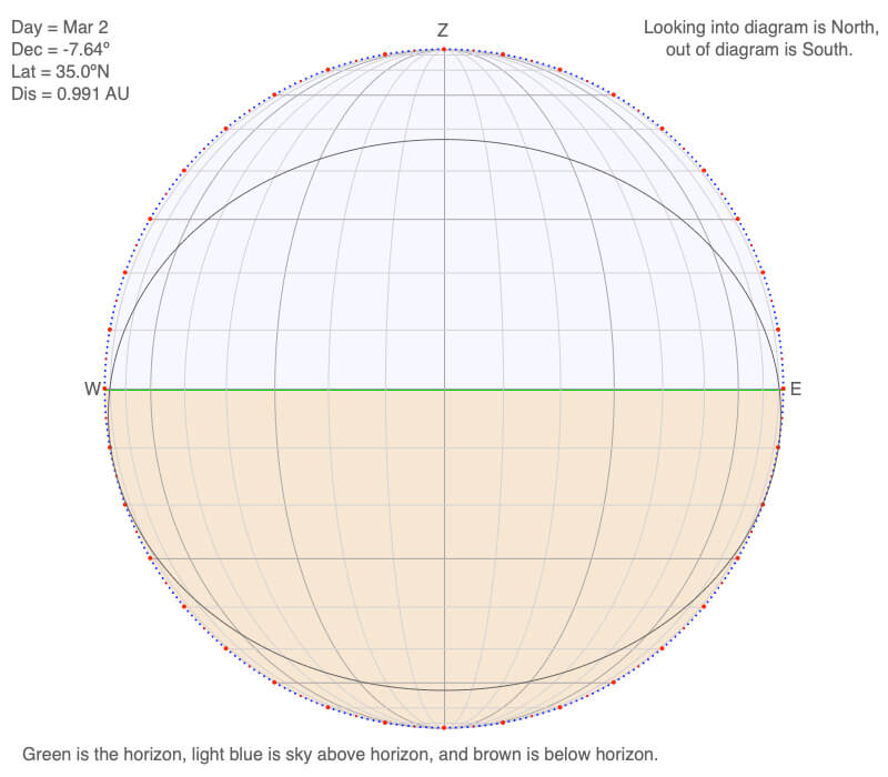
A east/west-oriented declination circle for 35ºN on March 2.
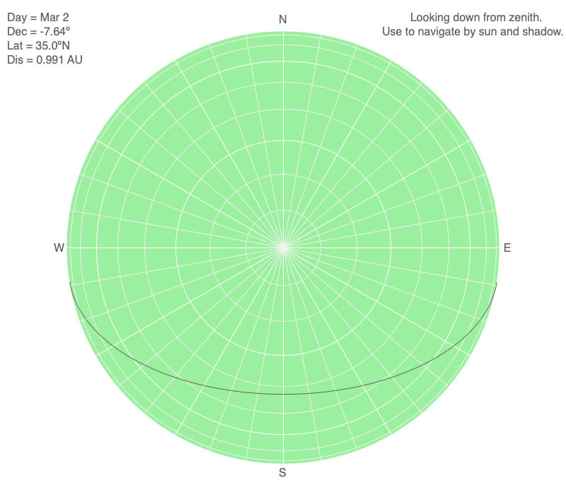
A declination circle viewed from above for 35ºN on March 2.
Try a variety of challenges to use the apparent motion of the Sun in photography, art, green technologies, agriculture, and energy-efficient buildings, to name a few.
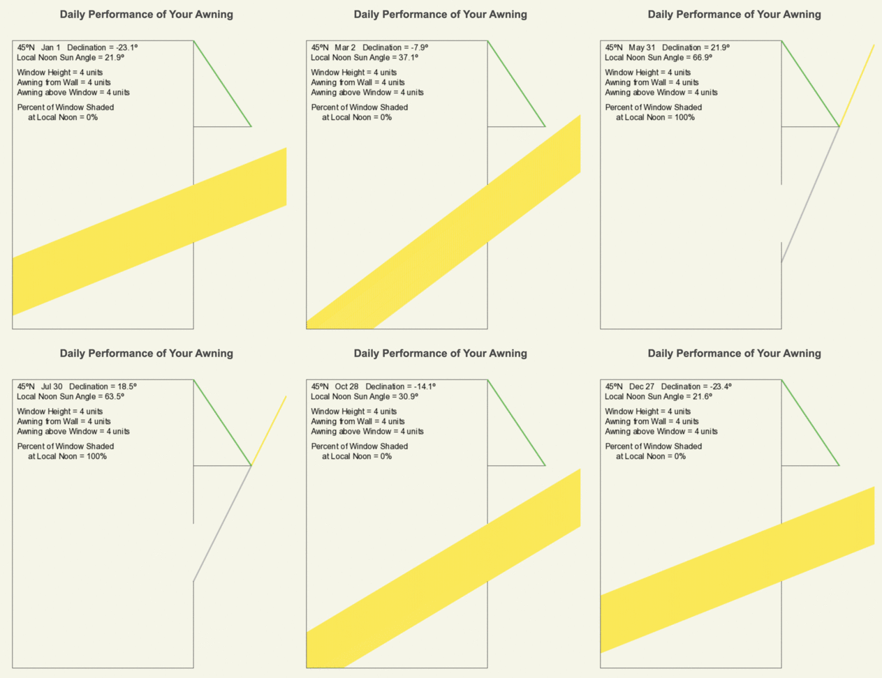
The following is an animation how an awning may be designed to block noon time sunlight from entering a window during the summer but let it enter in the winter.
Click on the following toggles to view descriptions and links of the web pages on each topic of the Sun-Earth Connection.
Sun-Earth Connection overview
An overview of how the Sun’s energy is generated and how its thermal radiation illuminates and heats Earth.
Earth Illumination Patterns
- Overview: The Sun illuminates the spherical, rotating planets orbiting it.
- Obliquity and Earth’s Illumination: Obliquity is the angle between the planes of the Earth’s equator and its orbit around the Sun.
- Declination, Latitude, & Earth Illumination: Solar declination is the angle between the Sun’s rays and the plane of the Earth’s Equator. Its value depends on where Earth is in its orbit around the Sun.
- Astronomical Seasons & Illumination: Astronomical seasons are based on the orientation of Earth’s axis of rotation to the Sun, which determines the amount of illumination between the Northern and Southern Hemispheres.
Distribution of the Sun's Energy on Earth
- Overview: Even though an area is illuminated by sunlight, there can be quite a range of energy interacting with the surface.
- Sun Angle and Beam Concentration: If every beam of sunlight reaching Earth has the same amount of energy, why do some areas warm up more than others?
- Diurnal Heating: Diurnal heating is the temperature change over 24 hours. When sunlight shines on the ground, it warms. Two critical factors that determine the amount of heating deal with the Sun’s illumination.
- Seasons: Earth experiences astronomical seasons due to its obliquity.
- Climate Regimes: Climate regimes are an extension of diurnal heating and seasons, but the time frame is now years.
Declination Circles: A tool to analyze the Sun's position in the sky.
- Overview: Drawings of declination circles contain the visual and numerical information to understand and predict the Sun’s motion across the sky.
- Declination Circles 101: Draw a declination circle with just a ruler and protractor/compass to quickly and accurately know the Sun’s position in the sky at any day and time of the year for any location on Earth.
- Drawing Declination Circles: Declination circles are quite easy to draw by hand.
- Interpreting Time on Declination Circles: Accurately estimate the time of day using the Sun’s location in the sky.
- Sunrise, Sunset, & Twilight: Calculate the timing and duration when the Sun is at or near the horizon.
- Solar Time, Angle, & Position: The sun’s angle and direction to the local horizon define the Sun’s position in the local sky. Explore how to use declination circles to calculate the Sun’s position at any solar time anywhere in the world on any day of the year.
- Changing Views of Declination Circles: Use the web app View Declination Circles to explore three common views of declination circles to identify their strengths, limitations, and applications. Then learn how to go from one view to another.
- Using Declination Circles: Humans have been using the apparent motion of the Sun as a compass, clock, and calendar for millennia.
- Using Sundials: Humans have been using the Sun’s position to navigate and tell the time, day, and season for millennia. Sundials create shadows that make it easier to do these tasks.

0 Comments